Se afișează postările cu eticheta geography. Afișați toate postările

27 noiembrie 2012

Dobrogea Plateau


Hello and welcome for a new presentation of geography of Romania. Today we will talk about Dobrogea Plateau.
Of geological, rock components give the area the nickname Dobrogea mountains. It has a height of only 467 m on top of Greeks (Tutuiatul). Orogenesis that generated the Dobrogea mountains Hercynic (Devonian / Permian) in the north and Caledonian (Cambrian / Silurian) in the center. Height is generally low due to exogenous processes that have acted by eroding material constituent of rocks, exposing present atmospheric (surface) when rocks were forming at the base of the mountain chain (Greek borders). Of geographic range of heights in Dobruja Mountains are quartered make classification of geographically the plateau, which is situated between the Danube valley in the west and Black Sea in the north and east, is the only large extra-Carpathian unit, with aflorate oldest geological and morphological structures in Romania. On the surface, the oldest rocks are Proterozoic in Plateau Casimcei green schists, with over 600 million years old. The foundation of South Dobrogea there oldest rocks identified in wells and covered Paleozoic sedimentary layers present, Mesozoic and Neozoic that have a much higher age (1.6 billion years).
Dobrogea Plateau appears as a relatively rigid plateau formed on ancient rocks (shale green borders) and Mesozoic sedimentary deposits Neozoic strongly eroded by the action of exogenous long, with a mild relief, slightly wavy and relatively low altitude (200 -300m). The northern part is higher, sometimes reaching to 350-400 m to 467 m but the highest peak (peak Greeks Macin Mountains). The south is under 200m (maximum altitude is 204 m in Plateau Deliorman). In terms of tectonic, Dobrogea Plateau belong to different Microplate: in the north, the Black Sea microplate located in a subduction process (along a Benioff plane) in the Curvature Carpathians and the Moesian microplate south (including the foundation of the Romanian Plain and Dobrogea South). There landforms associated influenced by petrography and structure: a relief "granitic" train debris and steep in Macin Mountains ancient eroded peneplain preserved on the surface of green shale, small karst forms on Jurassic limestones, waving large structural surfaces adapted Neozoic formations of South Dobrogea. There are also north (Macin Mountains, Hills Tulcea and Babadag), a set of forms of sedimentation (inselberguri, aprons erosion) and the substrate loess forms of settlement and sufoziune.
Dobrogea Plateau are the main subdivisions of the North Dobrogea Massif and South Dobrogea Plateau, separated by Harsova-Capu Midia line. North Dobrogea Massif is taller, with a varied relief and a general inclination from the Danube to the sea. Consists of Macin Mountains (also known as the Pricopan) Peak Niculitel Tulcea Hills (continue with porch Agighiol) Nalbant Depression, Babadag (stretched from the Danube to the Black Sea, with maximum altitude of 401m), Plateau Casimcei consisting of green shale (the maximum altitude 325m), continued Hamangia porch, Jurassic limestones intersected by a small river Casimcea generated complex karst (caves from the mouth of Dobrogea and "key" Dobrogea). Sometimes Casimcei Plateau is considered a separate major subdivision of Dobrogea, the same rank with the other two and called Central Dobrogea. South Dobrogea Plateau is lower (below 200m), is widely curly after Sarmatian limestone folds and tilts from the sea to the Danube. Have a strong endorheic valleys. South-west, with maximum altitudes of 204m, generically called "Deliorman" (continuing into Bulgaria). Subdivisions are high littoral zone, Medgidia Plateau (Valley of Carasu) Negru Voda and Plateau Plateau Oltina changed into.
Not too much, not too little. God bless you!

20 noiembrie 2012

Eastern Carpathians


Hello dear readers! A new day on Tuesday, we have a new geographical presentation, this time closer to what we learn in school.
Eastern Carpathians mountain is one of the major segments of the Carpathian Mountains, and is in Romania, Ukraine, Slovakia and Poland. Just as the name indicates, Eastern Carpathians are found in the eastern part of the mountain chain, featuring a wide variety of rocks, aspects geophysical, geological and morphological heights, afforestation, flora and fauna.
Are within the limits:
North: Subcarpatii Beskizi in Poland
Eastern Plateau Subcarpatii Beskizi in Ukraine and Moldova Moldova Subcarpatii
West: Color Michalovce-Nowy Sącz-Tarnów, Depression hills of Transylvania (DCT), West Hills West Plains
South Subcarpatii of curvature and Prahova Valley
Between these limits, have a number of features of the landscape which distinguishes them from other branches Carpathian such as:
values ​​are medium altitudes, maximum heights exceeding 2000 m (Rodna Mountains and Calimani) or close to this altitude (Ciucas Mountains, Maramures Mountains and Ceahlau)
have parallel ridges, oriented NW-SE direction (north and center) or "curved" (in the south)
consist of three parallel stripes reflect geological structure of the substrate:
a) in the west there is a line of volcanic mountains
b) in center, mountains made of hard rocks (predominantly crystalline schists)
c) in the east and south, mountains made of folded sedimentary rocks (called "flysch" = specific geological formation, composed of folded sedimentary layers)
are fragmented by numerous depressions (some very large, such as Brasov and Maramures), valleys and passes
have various forms of relief, such as volcanic landscape (with craters, cones and dishes), especially in Calimani, Gurghiului and Harghita glacial relief (Rodna Mountains), a specific relief due to rocks (especially in massive Ceahlau and Ciucas )
karst caves and gorges in the Curvature Carpathians
In the Eastern Carpathians are three major groups of mountains:
Maramures and Bukovina Carpathians, or northern group
Moldova Carpathians Transylvania or station group
Curvature Carpathians or southern group
North Eastern Carpathians group includes the following subdivisions: Mountain Oas, Gutai Mountains, Tibles, Maramures Mountains, Mountains Suhard, Bargau Mountains, Rodna Mountains with the highest peak here, Pietrosu 2303 m, Oas River Basin Tour, Maramures Depression on rivers Tisa, Iza and Viseu, in Bistrita Dorna Depression Depression liceale on Moldova, Prislop 1416 m, Şetref Pass, Tihuta Step, Step Mestecanis.
In Group Centre are: Calimani pointing Pietrosu of 2100 m, Gurghiului Mountains, Harghita Mountains, Mountains Ciomatu, Giurgeu, Hasmas Mountains, Mountains Ciuc Nemira Mountains, Mountains Bistrita Ceahlau Mountains, Mountains pen, Stanisoara Mountains, Mountains Gosmanu, Berzunti Mountains, Olt River Ciuc Depression, Depression Giurgeu river Mures River Basin Comanesti Trotus, Mures Spring Step, Step Bucin, Oituz Step, Step Tusnad.
In the southern group are Intorsurii Mountains, Mountains Bretcu, Barsa Mountains and Piatra Mare trained in Postavaru, Vrancea Mountains Buzau Mountains formed from Penteleu Siriu Podu Horse, Ciucas Mountains, Baiu Mountains, Brasov Depression Olt rivers and Black River, Depression Intorsura Buzau Buzau River, Step Predeal Bratocea, Step Oituz.
Tomorrow we'll talk about a representative momument for Romania.
God bless you!

13 noiembrie 2012

Cernavoda Nuclear Power


Hello! Today is Tuesday, we have the geographical studies in general. But we all know how well that goes hand in hand with geography, tourism, economics and other sciences, I will present Nuclear Central of Cernavoda, because recently appeared at least interesting information.
Cernavoda Nuclear Power is the only such center in Romania.
At present, units I and II, which together produce about 18% of electricity consumption in the country.
The initial plan, dating from the early 1980s, includes the construction of five units. Unit I was completed in 1996, has a power output of 706 MW installed annually produces about 5 TWh. Unit II was started on May 6, 2007, connected to the national power grid on 7 august and functioning normally in September 2007.
Nuclear reactors at Cernavoda uses Canadian CANDU known acronym. Heavy water is used as moderator, is produced in ROMAG PROD Drobeta Turnu Severin.
In very exceptional cases, when the Danube falls well and cooling water can not be pumped cooling, reactors must be stopped. This happened, for example, in August-September 2003, when the plant was shut for three weeks.
To achieve Units 3 and 4 at Cernavoda was chosen model of Companies Projects in partnership between the Romanian state and private investors through Nuclearelectrica. The six investors who submitted offers and were selected initially are: Arcelor Mittal Romania will hold 6.2 stake in the future companies CEZ Czech Republic - 9.15%, ENEL Italy - 9.15%, GDF Suez - 9 , 15%, Iberdrola Spain - 6.2% and RWE of Germany - 9.15%, while the Romanian state owns 51% of actiuni.In following the withdrawal GDF Suez, Iberdrola, CEZ Group and RWE Germany currently holds the Romanian state ( October 2011) 84.65% stake in SNN. The project company called EnergoNuclear was founded in March 2009 and the second unit is expected to be commissioned in 2015-2016.
But now aside figures and other economic data, it appears that the plant management decided to  start "Open door program" which obviously gives a character Cernavoda city tour and especially nuclear power. This program is done in order to prove the safety of the plant, wanting to achieve special holes for radioactive waste storage. Obviously, in order to be executed the consent of that building community and this is precisely allow for tourist visits,to demonstrate that there are no problems and that there is no risk of radioactive contamination. Also, although currently it is just a paper project, construction of terraces is desired. If it seems interesting, but should keep in mind that it is forbidden to take photos or videos.
Enough for today. I hope I have sparked your interest.
God bless you!

6 noiembrie 2012

Braila County


Hello dear readers! Today is Tuesday, so we have the geography and becouse a good friend of mine is coming from there, today I will present you some of the geography of Braila.
Braila is a county in the Wallachia region of Romania. Braila is one of the most interesting administrative units of the country.
The county is located in the eastern part of the country, the unit called the Romanian Plain. The surface of 4765.8 km ², representing 2% of the country, is a medium-sized county. Braila county seat is located 200 km north-east of Bucharest.
Braila County is bordered on the north by Galati, Tulcea County to the east, south-east of Constanta, south of Ialomita County, west of Buzau County and northwest of Vrancea county.
The geographical position is advantageous because natural conditions are favorable proximity economic and social development. Topography and climate favors housing, and the fertile soils rich agriculture is practiced. Danube holds large amounts of water and houses many creatures. Near the sea and the capital of the whole country and facilitates connections with Europe. All these elements give Braila accessibility and openness to the whole country.
Despite being dominated by plain, Braila County landscape is diverse and interesting. Stretched over many forms Baragan Plain consists relief: small mounds, which keeps water shallows, sand dunes, wide confluence of rivers, meanders, islands, sand banks. They give these lands uniqueness and charm.
And Danube rivers which cross the county are most important in carrying relief. First, the Danube River valley as required, in the field, two special units: plains in the west and Pond Braila, on the east side, then rivers, because they delimit subunits in the plain and because they are formed along meadows.
Territory located west of the Danube, is the largest part of the county stretching. On this stretch, plain topography is generally flat, broken by hillocks, valleys and lakes. Rivers bounding this area are Siret, lip and Calmatuiul.
Siret flows in the north of the county, forming a low plain that widens to the west, where it reaches a width of about 20 km from the confluence with the lip. This unit, called Lower Siret Plain is the lowest plains of the country, having, in the western part very low heights.
Buzau flows in the north-west of the county, with a low meadow called plain lip. This is presented as a sand-colored, 3-5 km wide, which Buzau created many sand banks and whites abandoned.
Calmatuiul flows in the south of the county and form, or along a sandy plain, which is part of Baraganul Ialomitei. This is higher than the valleys formed along the Siret and Buzau and includes Mohreanu Field South, where the greatest heights in the county (60 m) and plain red, sand cultivated.
In the central part of the county, between the Danube Meadow, Siret of Buzau and Braila Plain Calmatuiul runs. In the center of it there is a lower area as a dry valley, about 3 km wide, the course is supposed to be in the dark times of the Danube arm. This valley, which is also called bellows Iancului Braila Plain splits into two sectors:
Viziru eastern sector encompassing field;
Western sector comprising twins Field, Field and Field Ianca Mircea Voda.
Braila Pond in East County, the area encompassed between the two main branches of the Danube. It starts at bifurcation Danube north of Giurgeni and runs to the confluence of the two branches downstream of Braila. This area was once marshy very low, similar to Delta. In the last century, he was drained, dammed and turned into a land which is called the Big Island of Braila.
Big Island of Braila has an average length of 60 km and a width of up to 20 km. After draining, she became farmland, but to transform dry pond was necessary in a fierce fight with the waters of the Danube. Thus, the dams were built on a total length of 117 km, water was pumped inside and irrigation channels were built. Island became one of the most productive farmland in the country, but the natural landscape has been replaced with an artificial one, the environment was modified in depth and history of this transformation is marked by pain and injustice.
The western arm of the Danube waters are loose in several secondary courses that close, inside a flooded area known as the Island of Braila.
Island of Braila occupies an area much smaller than the Big Island, and took place in the main course and the arms of the Danube, the bifurcation Giurgeni-Vadu Oii up south of Braila, at the confluence of the Danube arm tie. Small Island preserves the natural landscape, which is very similar and is protected Danube Delta, the area was declared a natural park.
The county is composed of a municipality, 3 cities and 40 municipalities, the municipality is Braila.
That's about it for today! God bless you!

30 octombrie 2012

Fagaras Mountains


Hello and welcome back for a new geography lesson. The presentation for today will be longer becouse this part deserve this.
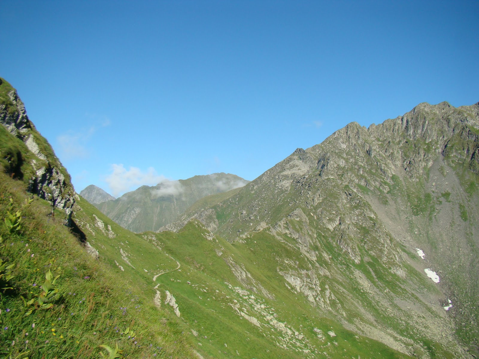
Fagaras Mountains are a mountain range which forms part of the Southern Carpathians, and is the highest mountain peak in Romania, Moldoveanu Peak 2544 meters. By Negoiu interwar period, with an altitude of 2536 meters, was considered the highest peak in the Carpathians, Tatras peaks exception.
Fagaras massif from east to west measured in a straight line, approximately 70 km from north to south and about 45 km. Fagaras mountains like a huge backbone oriented from east to west with ridges oriented north and south. Peaks in the north are much shorter and more abrupt than those of the south, which are long and smooth.
Fagaras Mountains are bounded on the west by the Olt Valley and east of the river Barsa Grosetului and Dambovita River. To the north are separated by a large tectonic steep, the Fagaras depression, also known as the Land of Olt. To the north, a distance of only 8-10 km, difference in reach over 2,000 meters. South, delimitation is much less pronounced, was made after long ridges 30-40 km (tiles, enslaved, Scarisoara, sand, ŽARNIĆ, etc..), The string depressions Campulung Bradetu, Arefu and Jiblea.
The total area covered by the Fagaras Mountains is more than 2,400 km ², being, for comparison, about 7.5 times the Bucegi Mountains. Throughout the extent of Fagaras there are eight peaks over 2,500 m: Moldoveanu 2,544 m, 2,535 m Negoiu with, Vistea Great 2527 m, 2522 m Caltun-Lespezi with, Hunt Buteanu to 2507 m, Cornu Caltun to 2510 m, Hartopu to 2506 m, 2501 m there with Dara also with 42 peaks over 2,400 m and more than 150 peaks over 2,300 m.
These peaks are separated by deep saddles, some down to below 2000 m (saddle ŽARNIĆ: 1932 m).
This density peaks, slopes, peaks and heights have attracted massive and called Transylvanian Alps, French scholar Emmanuel expression attributed to Martonne.
Detach from the ridge to the north and south, strong like stone buttresses, a large number of loins extend (up the mountain) located almost perpendicular to the ridge. They have different lengths and especially appearances as face north or south. Northern branches are mostly steep and rocky near the ridge, just below the mantle appease the coniferous forests that occur immediately falls below 1,700 m height Another feature of these branches is their appearance and sometimes very narrow edge serrated (eg edge Albota).
In striking contrast to the northern branches, which shall break the backs south ridge (Muntenia) are long and slow, partly covered by pastures.
Main ridge of Fagaras and northern branches subjected to the action of currents and disintegration caused by freezing and thawing stitching forming in some places very narrow, notched saddles such as: Port Arpasul the Dragon window, saddles of Serbota valleys (north), springs Scale and Negoiu (south).
Another feature of this is the numerous glacial mountains and alpine lakes located at high altitudes. Some of these lakes are fed by underground springs.
Lower valleys to the north (Transylvania), is mostly a direction nearly perpendicular to the ridge line, and their waters are forced - due to very inclined slope - to descend into jumps, forming numerous waterfalls. Among the most picturesque valleys are: valleys midwives, Serbota, Bale, Brezcioarei, Ucei Great and Ucisoara, Saturday.
Fagaras mountains are crisscrossed by the highest road in Romania, Transfagarasan.
Fagaras massif nature reserves are less than the wealth of endemic plants and beautiful landscape areas.
Baldea alpine and lake. With an area of ​​120.45 hectares, the reserve covers an area south of peaks guarded Buteanu Hunt (2508 m), Capra (2450 m) and Paltinu Mare (2480 m) on the western flank of Buteanu edge and on the eastern Balea edge. Reserve includes glacial Balea glacial lake of the same name, the largest glacial lake of Fagaras Mountains.
Reserve Arpasel. With an area of ​​736 ha reserve is located on the northern slope Arpasel the Fagaras Mountains, including alpine, subalpine and upper mountain from 2,500 m to 1,000 m altitude.
limestone from Turnu Red. Located near the village Turnu Red, comprises a strip of limestone superimposed on crystalline schists. Included in these limestones rich deposits of fossils, scientifically interesting.
Clothes Vegetable Fagaras Mountains is a very rich and varied. Compact forests cover the mountain slopes up to a height of about 1,700 m, and large meadows and glades - adorned with all kinds of flowers - span the banks of valleys, forest clearings or wavy lands under forest belt of the mountain.
Beyond the meadows begin beech forest region that covers much of the mountain foot. Beech grows here strong, tall and straight, forming forests really great. For the beauty of silver beech forests of the valley Bale as for other tourist values ​​that are over them (rocks, lakes and waterfalls), this valley was declared by the Commission for the protection of natural monuments nature reserve. In beech forest clearings and banks that water meets capreasca willow, birch, aspen, alder, raspberries, blackberries.
At the top of the forest, mixed with beech tree that is quite rare. Instead, his place is taken by spruce woodland occupying the entire region, from 1,100 to almost 1,700 m altitude.
Apart from these two representatives of conifers, in Fagaras still meet other resinous essences. Thus, larch and larch (Brezcioarei Valley) pin (Valley House, Mountain Slope), yew (in greater numbers Edge midwife) zambru rare specimens, and quite often juniper (Santa Edge). Of these, larch, yew and Zambra species are protected by law.
Above molidisului alpine start, often interrupted by numerous clusters of juniper trees, juniper, blueberry and cranberry. Is mainly alpine meadows covered (especially on the southern slope of the mountain) providing abundant food numerous flocks of sheep. Also in this area meet various species of flowers, some beautiful and interesting than others: smirdar, Campanu (bells dwarfs), gentiene, forget-me-not, panseaua mountain, Russian, Garofita mountain tribute. Of flowers protected by Law: Sunflower Queen, also known as "Edelweiss" brave blood, white ivy. In mid-June, up in the alpine mountain peony blossoms, which takes the form of a fragrant flowers, a bright red blanket enveloping the mountain as seen from a great distance, and when the wind blows feeling that burning mountain . Locals on the last Saturday in June used to climb, young and old, the peony festival.
Fagaras Mountains chain contains a rich fauna, both in subalpine areas, mostly covered by vast forests and alpine areas. Among mammals Carpathian bear (protected by law) is the most representative, maintaining shelters in many parts of the upper coniferous forests. In lower elevation forests, wild boars offers another precious game in both northern mountain lands and in the south. Marten and lynx are found less frequently. Instead, squirrel appears everywhere in the way of hiking in forest regions where the mainstay is the fox. Deer and deer forests give charm to the hem. Wolf is also present in these places.
Many birds beautifies forest life: meet scissors, finches, mountain cojoaice, woodpeckers, thrushes, wagtails berries, honey. Grouse and grouse are nestled in thickets. Of birds of prey living in heavily: eagles, hawks, eagles or griffins forest, wind, and rarely eagles rock. Many reptiles, some harmless as lizards mountain and batracienii gusterii such as salamanders, teeming with carpets of dead foliage. In some places, the slopes oriented towards the sun, inhabit and vipers. Many mountain streams and alpine lakes are now restocked with trout. Lives atop chamois, protected by law.
And with this we are finished for today! God bless you!


23 octombrie 2012

Turda Gorges


Hello and welcome to a new presentation, where we’ll discover how beautiful is Romania!
Today I will present you in few lines and images Turda Gorges which are of great splendor and tourism potential.
Turda Gorges form a protected area of ​​national interest corresponding to IUCN category IV (natural reserve of mixed type), located in Cluj county, at a distance of 6 km west of the city of Turda, along the valley Hasdate.
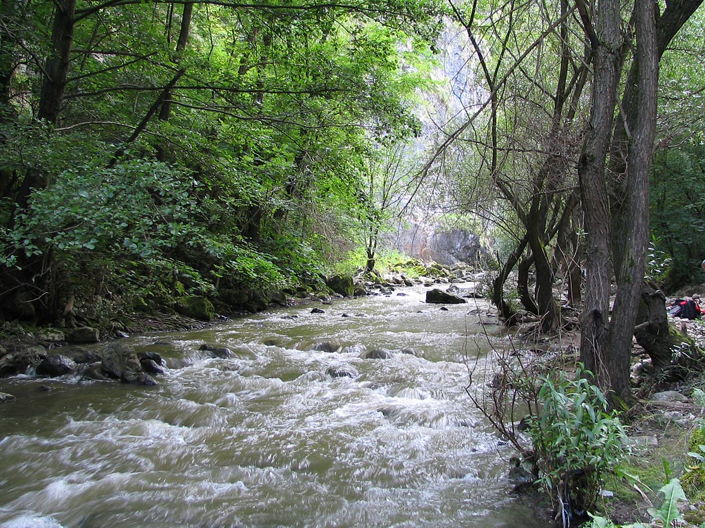
Have a length of 2,900 m and a height of walls up to 300 m Gorge occupies an area of ​​324 ha and were formed by erosion of Jurassic limestone rock by river Hasdate.
Turda Gorge offers a rare wild karst landscape: high cliffs and steep increases sharp stone towers, Valcele rocky debris, arcade, etc.. Contains over 1,000 species of plants, animals, butterflies, some rare items representing wild garlic, eagle rock, sogartul the pond, yew, mountain ash, Garofita white Wallcreeper.
Over water Hasdate valley there are 4 bridges. The first bridge (I) is located not far from the entrance keys, the last bridge (IV) to exit Key in the Lower Petreştii common direction.
In the section "Cut" 1.5 km from Turda Gorge entrance, located in the main Romanian career Potaissa city and the Roman camp. In the nineteenth century, when there were visible traces of Roman exploitation, detailed observations were made on the techniques of separation of blocks of limestone and massive advancement. Career was transported to the neighboring village church key to a high column of 1.5 m and 0.34 m diameter career and its surroundings were discovered tiles, keys, lamps, pottery and more currencies (a tetradrahmas a denarius during the Roman Emperor Domitian, a denarius from the reign of Macrinus and two coins). The findings indicate the existence of a settlement near limestone quarry.
Archaeological site under "White Hill" is inscribed on the list of historical monuments in Cluj County prepared by the Ministry of Culture and National Heritage of Romania in 2010.
As I said above in Turda Gorges there are about 1,000 species of plants, including Clover, allheal, tribute, purple iris, eagle, silver mountain ash, wild garlic, to and from the point of view of wildlife are present 67 species of birds, fish, frogs, foxes, weasels, stone marten, wild boars, rabbits, deer, snakes etc..
Turda Gorges bind through a series of trails other sights, such as Gorge Tour, Waterfall and Gorge Ciucas Borzeşti.
In the 30s of the twentieth century up to the rock on the left side of the key (in the direction of the water flow Hasdate valley) there is a large wooden cross. The cross was placed in the interwar period, in a public ceremony, which took part in both the local people as well as officials from Turda. After the war, the wooden cross was replaced with a metal cross that exists today.
In the mid-60s of the twentieth century on the ridge of the right side of the key (in the direction of the water flow Hasdate valley) there is an old wooden church, unused, in an old Greek Catholic Monastery. In 1968 the church was dismantled.
Gorges opened in 1935 in a cabin with medieval aspect, the area being retrofitted several holiday.
It is a favorite area for climbers because of verticality walls and relatively easy access to equipment. There are over 200 climbing routes and climbing, various competitions are held annually and memorials.
Ok, enough, too much talk!


God bless you and have a nice day!

16 octombrie 2012

Danube's Delta

Hello, people around the world!
Did you know it or not, Romania is an unique country in the world for many things it has, and one of them is present of the Denube's Delta, which entered the UNESCO World Heritage in 1991 and is classified as a biosphere reserve nationwide Romania as a national park in the IUCN international taxonomy.
Delta is limited to the south-west of Dobrogea Plateau, forms the border with Ukraine north and east flows into the Black Sea. Delta is crossed by the parallel 45° N latitude and the meridian of 29° longitude E. Delta deal with limanele Dobrogene, 5050 km², of which 732 km² are in Ukraine, Delta Romanian accounting for and an area of ​​2540 km². Because of the 67 million tons of sediment to the Danube Delta grows annually approx. 40 m².
Danube arrived at Patlageanca bifurcate: Chilia north and south of Tulcea, which then fog arm Saint George, splits in Sulina and Sf Gheorghe arm.
Chilia, forms the border with Ukraine, carries on its course by a length of 104 km², 60% of water and silt Danube.
Sulina is situated in the heart of the Delta, and unlike Chile, has a linear course, being continually dredged and maintained navigation maritime vessels. Has a length of 71 km and carry 18% of the water of the Danube.
During Sf Gheorghe faces south-east, and runs on 112 km, carrying 22% of the Danube flow. Form islands at the mouth Sacalin considered a secondary delta.
Delta (except secondary delta Chilia) is traditionally part of Dobrogea, but in antiquity and the Middle Ages, Black is more to the west (between Chile and Murighiol Old Strabo's time, between Lake Dranov Periprava and Byzantine era ), so historical maps covering all Delta today is Dobrogea are false geomorphology.
Delta is placed, in geological terms, in a region called the land cover mobile platform Danube Delta (predobrogeana region). Delta platform comes in contact in the south-west with the North Dobrogea Orogen by Oancea fault-St. George, which is roughly parallel to the arm Saint George.
According to studies done by research, its geological structure consists of a crystalline foundation over which one has transgressive sedimentary sequence represented by deposits Paleozoic, Triassic, Jurassic, Cretaceous, Neogene and Quaternary, induced by drilling large and shallow conducted in the area.
Delta, located in the northwestern part of the Black Sea is of geomorphological relief accumulation developed at the mouth of the Danube to the Black Sea.
According to FAO classification, the Danube Delta is included in the category of regional landforms type fluvial plain wet alluvial deposits with high fragmentation.
Delta is characterized by positive landforms called levees and negative landforms represented by depressions filled with water (lakes). Today, Delta is in the form of a flat surface with a slope of 0.006 ‰, crossed by a web of water: river arms, canals and streams, dotted with lakes and backwaters. Differences in elevation above sea level, are 8-10 m in the levees and -2 to -4 m in the lake depressions.
Delta fall into specific semiarid temperate climate space Pontic steppe. Flat water and very large spaces, covered in varying degrees of vegetation, interrupted by fields of marine sandy islands, form a specific active surface delta and adjacent lagoons, quite different from the Pontic steppe. This active area responds to the total radiation received and the general circulation of the atmosphere resulting in a mosaic of microclimates.
Delta vegetation consists largely of specific wetlands vegetation (reeds, rushes, sedges, mixed with dwarf willow) and occupies 78% of the total area. Meadows occupy 6% of the delta area, the forests of willow, ash, alder, poplar growing on fluvial being periodically flooded and pools of water covered by aquatic vegetation and floating, holding 2% of suprafaaa delta. There are also forests and fields Letea and Caraorman are made of gray oak, English oak, ash, aspen, elm, creepers.
It contains more than 320 species of birds as 45 freshwater fish species in its numerous lakes and backwaters. This is the place where millions of birds from different corners of the Earth (Europe, Asia, Africa, the Mediterranean) come to nest. Major fish species in the Delta are pike and catfish.


Enough geography for today!
Good day and God bless!

13 octombrie 2012

Let know Romania!


Hello everybody!
From this coming Monday, this blog will have a new page for people around the world who want to know about Romania, its culture, history, magnific lands, important artists, scientists and monuments. Furthermore, in Sundays we will have few words from Bible or just a christian message.
First of all, I want to inform you about a very important thing: this page will be just a traslated one from the romanian original „HAI CA PUTEM!” page. This is becouse I want to respect all the people equally, romanian or others and becouse of the time limit I have to write, too.
Secondly, as you probably guessed, both pages will have the same program and it looks like this:
-          Monday – history
-          Tuesday – geography
-          Wednesday – monuments
-          Thursday – personalities
-          Friday – sport
-          Saturday – no posts
-          Sunday – faith
So this is it and I hope you will appreciate the articles, becouse i will put all my love in it for makeing somthing good for you, my readers.
God bless you!