Se afișează postările cu eticheta Romania. Afișați toate postările

27 noiembrie 2012

Dobrogea Plateau


Hello and welcome for a new presentation of geography of Romania. Today we will talk about Dobrogea Plateau.
Of geological, rock components give the area the nickname Dobrogea mountains. It has a height of only 467 m on top of Greeks (Tutuiatul). Orogenesis that generated the Dobrogea mountains Hercynic (Devonian / Permian) in the north and Caledonian (Cambrian / Silurian) in the center. Height is generally low due to exogenous processes that have acted by eroding material constituent of rocks, exposing present atmospheric (surface) when rocks were forming at the base of the mountain chain (Greek borders). Of geographic range of heights in Dobruja Mountains are quartered make classification of geographically the plateau, which is situated between the Danube valley in the west and Black Sea in the north and east, is the only large extra-Carpathian unit, with aflorate oldest geological and morphological structures in Romania. On the surface, the oldest rocks are Proterozoic in Plateau Casimcei green schists, with over 600 million years old. The foundation of South Dobrogea there oldest rocks identified in wells and covered Paleozoic sedimentary layers present, Mesozoic and Neozoic that have a much higher age (1.6 billion years).
Dobrogea Plateau appears as a relatively rigid plateau formed on ancient rocks (shale green borders) and Mesozoic sedimentary deposits Neozoic strongly eroded by the action of exogenous long, with a mild relief, slightly wavy and relatively low altitude (200 -300m). The northern part is higher, sometimes reaching to 350-400 m to 467 m but the highest peak (peak Greeks Macin Mountains). The south is under 200m (maximum altitude is 204 m in Plateau Deliorman). In terms of tectonic, Dobrogea Plateau belong to different Microplate: in the north, the Black Sea microplate located in a subduction process (along a Benioff plane) in the Curvature Carpathians and the Moesian microplate south (including the foundation of the Romanian Plain and Dobrogea South). There landforms associated influenced by petrography and structure: a relief "granitic" train debris and steep in Macin Mountains ancient eroded peneplain preserved on the surface of green shale, small karst forms on Jurassic limestones, waving large structural surfaces adapted Neozoic formations of South Dobrogea. There are also north (Macin Mountains, Hills Tulcea and Babadag), a set of forms of sedimentation (inselberguri, aprons erosion) and the substrate loess forms of settlement and sufoziune.
Dobrogea Plateau are the main subdivisions of the North Dobrogea Massif and South Dobrogea Plateau, separated by Harsova-Capu Midia line. North Dobrogea Massif is taller, with a varied relief and a general inclination from the Danube to the sea. Consists of Macin Mountains (also known as the Pricopan) Peak Niculitel Tulcea Hills (continue with porch Agighiol) Nalbant Depression, Babadag (stretched from the Danube to the Black Sea, with maximum altitude of 401m), Plateau Casimcei consisting of green shale (the maximum altitude 325m), continued Hamangia porch, Jurassic limestones intersected by a small river Casimcea generated complex karst (caves from the mouth of Dobrogea and "key" Dobrogea). Sometimes Casimcei Plateau is considered a separate major subdivision of Dobrogea, the same rank with the other two and called Central Dobrogea. South Dobrogea Plateau is lower (below 200m), is widely curly after Sarmatian limestone folds and tilts from the sea to the Danube. Have a strong endorheic valleys. South-west, with maximum altitudes of 204m, generically called "Deliorman" (continuing into Bulgaria). Subdivisions are high littoral zone, Medgidia Plateau (Valley of Carasu) Negru Voda and Plateau Plateau Oltina changed into.
Not too much, not too little. God bless you!

23 noiembrie 2012

Polo in Romania


Hello dear readers! Today I will present you an article that I just got over it because is very beautiful and is drawn directly from the appropriate source.
How and when playing polo appeared in our country? Quite late, compared to other countries in Central, or West of our continent, about the end of the third decade. First form of entertainment (and entertainment) of swimmers at the end of training or competitions. Pull the two gates in water immediately appear a leather ball, similar to that used by players and teams made up on the spot. By 1931 - Romanian Swimming Federation was established on 21 December 1930 - may not be an organized activity.polo
Exists today in Romania old specialists say that the first European Championship Polo organized in 1926, in Budapest, was present and selected our country. Consulting all official documents to premiere this competition, I found confirmation required. Only in the press of the time in 1928 I could meet a note about the first official game, which opposed selectionatele Oradea and Cluj and ended indecisively: 3-3. A year later, in Cluj, was held the first match between two club teams: University-MSE Tg. Mures 8-6. And in 1930, the same band of students simply blow Cluj - 12-1 (6-0) - a team of TCR Bucharest -'s.
Bucharest, Oradea, Cluj, Tg. Mures Timisoara - these were cities that occurred first polo team, composed mostly of swimmers. In 1932, Cluj University met again on MSE Tg. Mures, defeating 4-1.
A sports Almanac 1933 National Championships reminds us conduct swimming (swimming, water polo and diving) to Kisseleff (from the road) in Bucharest, on days 3,4 and 5 September. Polo, the winner was awarded a trophy called "FA Cup". The first day: M.S.E. Tg. P.T.T Mures. Bucharest 4-1 (3-1) and ILSA C.F.R Timisoara. Bucharest 6-1 (2-0). Surprisingly, sport game with student, university Cluj had not! The next day was the sport among the students in the match with poloistii forfaiteze Mures. So the final opposite the last day of competition on MSE Tg. Mures and ILSA. Timisoara were players techniques, but slower and could not oppose vigorous poloisti Mures, 4-0 winners (2-0). At M.S.E. then played Szigyarto, Vance, Schwartz, Henselman, Kovacs, Muller and Daroczi that I could meet and swim among the protagonists races and colors ILSA, they were machines Bader, Molnar, Chefer, Ravasz, Fischer, Lustig and Freund. Finally reissued the following year Muresenilor success (3-2) were obtained at the end of a fierce battle.
Ready! Maybe we cand do ome sport today! God bless you!

22 noiembrie 2012

I.C. Bratianu


Hello dear readers! Today is a beautiful Thursday and as as you probably used to know we’ll an overview of a personality this day.
IC Bratianu was born in Pitesti on June 2, 1821 and died in flower village in Arges County on May 16, 1891. He was a Roman politician, brother of Dumitru C. Bratianu. He attended primary school in Pitesti having as teacher Nicholas Simonida. He joined the Wallachian army in 1838 and visited Paris to study. Returned to Wallachia and took part, along with his friend, CA Rosetti and other prominent politicians, the Romanian uprising of 1848, the prefect of police in the provisional government of that year.
After restoring Russian and Ottoman, shortly afterward, moved into exile, fleeing to Paris, the French wanted to influence public opinion in favor of the proposed union and autonomy Danubian principalities.
He was initiated into Freemasonry as a brother, Dumitru Bratianu in 1846 in Paris Athenaeum Lodge stranger, then Rose Lodge affiliates perfect silence that is granted on 14 July 1847, Master degree. In 1848 he affiliated Brotherhood Lodge Bucharest, then return to Paris, where he will be arrested after a few years to participate in the attack against Napoleon III. Returns to Bucharest and founded in 1857, together with other brothers and they return from exile, Lodge Star of Danube. [1]
During the reign of Alexandru Ioan Cuza (1859-1866), Bratianu was a prominent liberal leader. He attended the deposition of Cuza in1866 and the choice of Prince Carol of Romania, whose reign had several ministerial appointments over the next four years. He was arrested for complicity in the revolution of 1870, but released shortly.
In 1876, aided by Constantin A. Rosetti, formed a Liberal cabinet, which remained in power until 1888, the Minister during the Russo-Turkish War of 1877, the Congress of Berlin, forming the Roman Kingdom, the revision of the constitution and other reforms .
After 1883, Bratianu was the only leader of the Liberals, with the help of CA Rosetti friend and political ally of and for nearly forty years.
Apart from being a Romanian politician during the critical years 1876-1888, was a writer IC Bratianu. His political pamphlets in French: Memoire sur l'empire d'Autriche dance in question d'Orient (1855), Reflexions sur la situation (1856), Memoire sur la situation from Le Trait depuis Moldavie of Paris (1857) and The Question religieuse en Roumanie (1866) were well received in Paris.
He had eight children with Bratianu Market: flowers, missing only three years, Sabina (1863-1941, married to Dr. Constantin Cantacuzino), John (1864-1927, five times Prime Minister's largest and politician Romanian state), Constantin (1867-1950, civil engineer and agronomist, the last president of PNL), Vintila (1867-1930, Prime Minister, Mayor of the Capital modernizer, Mary (1868-1945, poet Ion Pillat mother), Tatiana (1870-1940) and Pia (1872-1946, married Alimanesteanu).
I expect youtomorrow too to present you an article in the sports world.
God bless you!

21 noiembrie 2012

Parliament Palace


Hello dear readers! As I promised I will present you today a very important momnument for Romania! Therefore talk about Parliament Palace, or as it is also called as House of People.
Parliament Palace in Bucharest, Romania, measuring 270m by 240m, 86m high and 92m below ground. It has 12 levels and another 8 ground surface. According to the World Records Academy, Parliament House is the largest civilian administrative building for use as a surface in the world, most expensive administrative building in the world and the heaviest building in the world, going three times in Guinness World Records. Parliament House building is situated in the central part of the city (sector 5), the place that today is called Arsenal Hill, surrounded by Spring Street to the west and northwest, UN Avenue north of Liberty Avenue to the east and Route 13 September in the south. It is 10 minutes away from Unirii Square and 20 minutes from North Station (bus 123).
Hill where today is the Palace of Parliament is generally a creation of nature, with an initial height of 18 m, but Liberty Avenue side is raised artificially.
After the earthquake of March 4, 1977, Nicolae Ceausescu sought a site to develop a very large investment. He took the idea of ​​King Charles II in 1935, whose project was provided in the Chamber of Deputies on Arsenal Hill building. This project was designed by the greatest architects of the time. In 1938 he announced the start of demolition in order to open this pin. World War II came and things remained only on paper until 1983, when he started building the Parliament House, the official ceremony took place fundamental stone of the settlement on June 25, 1984.
The building has a usable area of ​​330,000 m², joined in "Guinness World Records" under "Administrative Buildings" at # 2 in the world after the Pentagon, and in terms of volume of 2,550,000 m³ of his people, 3rd in the world after the missile assembly building space from Cape Canaveral in Florida and Quetzalcoatl Pyramid in Mexico. For comparison it may be mentioned that the building exceeds 2% volume of Cheops pyramid in Egypt, and therefore some sources characterizes as one "Pharaoh".
Began during the Communist regime (calling themselves "Golden Age" of Romania and violently removed by the Revolution of 1989), the so-called Project Bucharest was an ambitious project of Ceausescu began in 1978 as a replica of the city Pyongyang, capital of North Korea. A project of systematization existed since the 30s (the time of Charles II) for the Union - Arsenal Hill.
After the earthquake of 1977 Nicolae Ceausescu ordered the "reconstruction" of Bucharest as a new town by itself. In the years 1978-79 there was a national competition for rebuilding city. The contest lasted nearly four years and was won by Anca Petrescu, a young architect only 28 years old, who was named chief architect of this project exceptionally controversial.
The yard itself began in 1980 with the demolition of over 7 km ² in the old city center and the relocation of over 40,000 people in this area. Of missing buildings include Vacaresti Monastery, Brancovenesc Hospital, National Archives, Republic Stadium, etc.. The works were made with forced labor conscripts, and the cost was minimized.
This project of reconstruction of the city, contained a number of buildings such as Parliament House - House Republic, Ministry of Defence, Radio House, Marriott Hotel - Guest House, House of the Romanian Academy, Spring Park and Union Boulevard - Victory of Socialism.
In 1989 the building costs were estimated at U.S. $ 1.75 billion, and in 2006 to 3 billion.
There are three vertical registers, which correspond also the distinct functional areas.
The building has about 1,000 rooms, 440 offices, over 30 halls and rooms, four restaurants, three libraries, two underground parking, a concert hall.
Name halls and salons of Palace of Parliament were elected after 1989, evoking events in the history of the Romanian people and personalities known worldwide.
Most are related to Roman aspiration for unification and the history of parliamentarianism in Romania.
I propose you to continue in the next 2-3 Wednesday with the presentation of the most important rooms of this magnificent monument.
God bless you!

20 noiembrie 2012

Eastern Carpathians


Hello dear readers! A new day on Tuesday, we have a new geographical presentation, this time closer to what we learn in school.
Eastern Carpathians mountain is one of the major segments of the Carpathian Mountains, and is in Romania, Ukraine, Slovakia and Poland. Just as the name indicates, Eastern Carpathians are found in the eastern part of the mountain chain, featuring a wide variety of rocks, aspects geophysical, geological and morphological heights, afforestation, flora and fauna.
Are within the limits:
North: Subcarpatii Beskizi in Poland
Eastern Plateau Subcarpatii Beskizi in Ukraine and Moldova Moldova Subcarpatii
West: Color Michalovce-Nowy Sącz-Tarnów, Depression hills of Transylvania (DCT), West Hills West Plains
South Subcarpatii of curvature and Prahova Valley
Between these limits, have a number of features of the landscape which distinguishes them from other branches Carpathian such as:
values ​​are medium altitudes, maximum heights exceeding 2000 m (Rodna Mountains and Calimani) or close to this altitude (Ciucas Mountains, Maramures Mountains and Ceahlau)
have parallel ridges, oriented NW-SE direction (north and center) or "curved" (in the south)
consist of three parallel stripes reflect geological structure of the substrate:
a) in the west there is a line of volcanic mountains
b) in center, mountains made of hard rocks (predominantly crystalline schists)
c) in the east and south, mountains made of folded sedimentary rocks (called "flysch" = specific geological formation, composed of folded sedimentary layers)
are fragmented by numerous depressions (some very large, such as Brasov and Maramures), valleys and passes
have various forms of relief, such as volcanic landscape (with craters, cones and dishes), especially in Calimani, Gurghiului and Harghita glacial relief (Rodna Mountains), a specific relief due to rocks (especially in massive Ceahlau and Ciucas )
karst caves and gorges in the Curvature Carpathians
In the Eastern Carpathians are three major groups of mountains:
Maramures and Bukovina Carpathians, or northern group
Moldova Carpathians Transylvania or station group
Curvature Carpathians or southern group
North Eastern Carpathians group includes the following subdivisions: Mountain Oas, Gutai Mountains, Tibles, Maramures Mountains, Mountains Suhard, Bargau Mountains, Rodna Mountains with the highest peak here, Pietrosu 2303 m, Oas River Basin Tour, Maramures Depression on rivers Tisa, Iza and Viseu, in Bistrita Dorna Depression Depression liceale on Moldova, Prislop 1416 m, Şetref Pass, Tihuta Step, Step Mestecanis.
In Group Centre are: Calimani pointing Pietrosu of 2100 m, Gurghiului Mountains, Harghita Mountains, Mountains Ciomatu, Giurgeu, Hasmas Mountains, Mountains Ciuc Nemira Mountains, Mountains Bistrita Ceahlau Mountains, Mountains pen, Stanisoara Mountains, Mountains Gosmanu, Berzunti Mountains, Olt River Ciuc Depression, Depression Giurgeu river Mures River Basin Comanesti Trotus, Mures Spring Step, Step Bucin, Oituz Step, Step Tusnad.
In the southern group are Intorsurii Mountains, Mountains Bretcu, Barsa Mountains and Piatra Mare trained in Postavaru, Vrancea Mountains Buzau Mountains formed from Penteleu Siriu Podu Horse, Ciucas Mountains, Baiu Mountains, Brasov Depression Olt rivers and Black River, Depression Intorsura Buzau Buzau River, Step Predeal Bratocea, Step Oituz.
Tomorrow we'll talk about a representative momument for Romania.
God bless you!

15 noiembrie 2012

Pantelimon Halippa


Hello dear readers! Today I will present you an important personality in Romania. It is almost imposible to find somebody in Romania and more especially in Bucharest who don’t heard the name Pantelimon. But how many of you know about Pantelimon Halippa?
Pantelimon Halippa or Pan Halippa was born on 1 august 1883 in Cubolta, Soroca County and died 30 April 1979 in Bucharest. He was a Bessarabian Romanian journalist and politician, one of the leading campaigners for the affirmation of the Romanian spirit for uniting the provinces of Bessarabia and Romania. He was president of the Country's Council who voted the union in 1918. He served on the minister in various governments. It was politically persecuted and imprisoned by the communist regime in Sighet. Excluded member of the Romanian Academy in 1948, reinstated in 1990.
He attended primary school in his native village in Cubolta, and courses School Edinet Spiritual and Theological Seminary in Chisinau. After graduating from seminary in 1904, he enrolled at the Faculty of Physics and Mathematics of the University of Dorpat (now Tartu, Estonia). A year later Halippa Revolution broke and was forced to quit studies. Back to Chisinau, approached the young Romanian intellectuals, working to "magazine Bessarabia", the first Romanian publication of the era in which the printed pages revolutionary anthem Wake up, Romanian, for which he was pursued by tsarist authorities.
Took refuge in Iaşi and joined the faculty of letters and philosophy, whose lectures he attended between 1908 and 1912. During this period he worked at "Romanian Life" in which he published "Letters from Bessarabia". In 1908 he printed in Chisinau, in Cyrillic, "Proverbs and novels", the first book of literary Bessarabia, and in 1912 his "Bessarabia geographical sketch". Returned to Chisinau in 1913, published together with Nicolae Vasile Alexandri and with Stroescu newspaper "Moldovan Word", whose director was. In his writings, Halippa not ceased to fight for the unification of Bessarabia with Romania.
Political activity intensified, and in 1917 established the Moldavian National Party. 1918 found the Halippa the forefront of current pro-union, for which he was elected vice-president, then president of the Country's Council, adding that the March 27, 1918, voted unification of Bessarabia with Romania. He attended meetings of the Chernivtsi and Alba-Iulia that proclaimed the union of Bukovina and, respectively, of Transylvania with Romania.
After 1918 he held several positions: Minister, State Secretary for Bessarabian (1919-1920), Minister of Public Works (1927), Minister of Public Works and Communications (1930), Minister ad interim at the Ministries of Labour, Health and Care Social (1930), secretary of state (1928-1930, 1932, 1932-1933), Senator and Member of Parliament (1918-1934), constantly seeking cultural advancement of Bessarabia.
In 1923 became a member emeritus of the Sovereign Sanctuary of Romania and in the same year, on December 29, represent Freedom Lodge in Chisinau, the annual convention of the National Grand Lodge of Romania (MLNR). In 1925 he was part of the Commission's external relations MLNR. He also acted as guarantor of friendship in our country's Supreme Council 33rd Degree of Santo Domingo. [1]
Halippa Panteleimon founded the Popular University of Moldova (1917), the Conservatory Moldavian writer and journalist Bessarabian Society, the Society of Publisher and Bookstore "Star" in Chişinău (1940). In 1932 he edited and led magazine "Life Bessarabia" and eponymous daily newspaper.
In 1950 he was arrested and jailed without trial, in Sighet, two years after being handed over to the NKVD, led to Chisinau, tried and sentenced to 25 years of forced labor in Siberia. It was moved to the Aiud prison where he was held until 1957. He died at 95 years in Bucharest, in the house on Al. Donici no. 32.
He wrote over 280 poems, articles, sketches, translations, memoirs, managing to edit in life only one volume fallow Flowers (1921, Iaşi), prefaced by Sadoveanu. He also wrote several historical studies: Bessarabia doprisoedineniâ k Rossii (1914), Bessarabia under Emperor Alexander I (1812-1825), Hasdeu "(1939). And published posthumously in "Heritage" in Chisinau Story of My Life (1990) and a volume of journalism (2001). In collaboration has also signed the book for posterity Testament (1991). Corresponding member of the Romanian Academy (1918). Excluded in 1948 Halippa was reinstated in 1990 as a member of the Romanian Academy.
That's it for today. Have a good and blessed day!

14 noiembrie 2012

Mogosoaia Palace


Hello dear readers! Even if it's cold and cloudy outside (in Bucharest, Romania),it does not means we can not still enjoy a short reading, but even the contrary. Today I will present you in few lines Mogosoaia Palace, following a suggestion received from a close person.
Mogosoaia Palace is a historical building in town Mogosoaia, Ilfov County, Romania, located about 15 km from the city center. The complex contains the actual building, its courtyard with the watchtower, cuhnia (kitchen), guest house, glaciers and Bibescu family tomb and the church "St. George" located near the courtyard walls. Palace widow named Mogos squire who owned the land on which it was built.
Mogosoaia Palace Brancoveanu was in possession of the family for about 120 years, then going Bibescu family owned.
And to solve a little problem of the history of this palace, it was built in 1702 by Romanian Constantin Brancoveanu Renaissance architectural style (or style Brancoveanu), a combination of Venetian elements with elements Ottoman style previously used and at another palace built by the ruler to Potlogi.
After 1714, when Constantin Brancoveanu was executed in Constantinople with his entire family, all family property was confiscated by the Ottomans and the palace was turned into an inn. Stephan redeemed Cantacuzino He then returned money Constantin Brancoveanu great grandson Prince, and remained in possession of the family until the early nineteenth century.
The palace was devastated by the Ottomans in the Russo-Turkish war of 1768-1774, because big money Brancoveanu Nicholas had held the Russians in conflict. A new palace destruction took place during the revolution of 1821 when the last descendant of Brancoveanu, Gregory Brancoveanu ran in Brasov and the building was occupied by dolphins. After Gregory's death in 1832, the palace remained legacy his adoptive daughter, Zoe Mavrocordat and, through her marriage to Prince George Bibesco passed his family and was renovated between 1860-1880 by Nicholas Bibescu, who built the family tomb palace park and nearby villa Elchingen. The palace was still family run Bibescu which, however, moved to the new villa and the old building remained uninhabited. It until 1911, when Mary-Nicole Darvari palace has sold her cousin George-Valentin Bibescu, who gave as wedding gift to his wife, Martha.
Bibescu Martha was busy renovating the palace since 1912. During World War I, renovation work were other damages suffered brake from German bombing. During the German occupation of the city and southern Romania, Princess Martha Bibescu remained in the capital, dealing the Queen Mary Hospital and lived for a while in the palace.
Returned home after starting in London, accused of collaborating with the Germans, Martha Bibescu renovation work resumed after 1920, spending much of his wealth gathered from books he wrote. The palace was reinaugurat so, in 1927, some interior work continued, however, until 1935.
During the Second World War, the palace was allied diplomats meeting place of being, for a few months rent Swiss legation in Romania. After March 6, 1945, the estate was nationalized by the communist government forced Martha Bibescu obtaining from the authorities declared a historical monument of the palace, which I still owned. Princess left the country permanently but in September 1945, leaving the palace his daughter Valentina and her husband, Demetrius Ghika-Comanesti.
In 1949, the palace was also nationalized, Valentina and Dimitrie Ghika-Comanesti being arrested. Until 1957, the building was destroyed and robbed, art collections being stolen and dismantled. Only in 1957 the palace became the seat of feudal division of the National Art Museum, the restored since 1977.
Currently holds Mogosoaia Palace Art Museum Brancoveneasca and is a major tourist attraction.
The main building of the complex is Mogosoaia Palace built by Constantin Brancoveanu, with princely family apartments on the first floor, which leads directly outside the yard on a scale that gives a front balcony located. The ground floor contains the palace servants' rooms and the basement is a basement with a ceiling of four domes. Facade of the lake is also a particular one inspired a Venetian loggia with three arches.
Cuhnia (kitchen Brancoveanu) is in the palace courtyard, with four ventilation towers. Tower guards the entrance gate to the yard. In it can climb a ladder outside. Both gate tower, and was restored by Martha cuhnia Bibescu between 1922 and 1930.
George Chapel Bibescu houses built after 1880 Bibescu family tombs, including Prince Michael and George Basarab-Brancoveanu, airmen killed during the Second World War.
Mogosoaia greenhouses were built after 1890 by French architects and are still used for growing flowers as art education workshop for children.
Glacier in summer served to store ice brought from Lake Mogosoaia nearby.
The church "St. George" is outside the palace walls, near the gate tower. Founded by Constantin Brancoveanu and finished in 1688, shortly before its founder to become ruler, it houses the tomb of George-Valentin Bibescu and votive painting what is Constantin Brancoveanu and four sons.
I stretched a little bit in this article, but I think it was worth it. Do you agree?
God bless you!

13 noiembrie 2012

Cernavoda Nuclear Power


Hello! Today is Tuesday, we have the geographical studies in general. But we all know how well that goes hand in hand with geography, tourism, economics and other sciences, I will present Nuclear Central of Cernavoda, because recently appeared at least interesting information.
Cernavoda Nuclear Power is the only such center in Romania.
At present, units I and II, which together produce about 18% of electricity consumption in the country.
The initial plan, dating from the early 1980s, includes the construction of five units. Unit I was completed in 1996, has a power output of 706 MW installed annually produces about 5 TWh. Unit II was started on May 6, 2007, connected to the national power grid on 7 august and functioning normally in September 2007.
Nuclear reactors at Cernavoda uses Canadian CANDU known acronym. Heavy water is used as moderator, is produced in ROMAG PROD Drobeta Turnu Severin.
In very exceptional cases, when the Danube falls well and cooling water can not be pumped cooling, reactors must be stopped. This happened, for example, in August-September 2003, when the plant was shut for three weeks.
To achieve Units 3 and 4 at Cernavoda was chosen model of Companies Projects in partnership between the Romanian state and private investors through Nuclearelectrica. The six investors who submitted offers and were selected initially are: Arcelor Mittal Romania will hold 6.2 stake in the future companies CEZ Czech Republic - 9.15%, ENEL Italy - 9.15%, GDF Suez - 9 , 15%, Iberdrola Spain - 6.2% and RWE of Germany - 9.15%, while the Romanian state owns 51% of actiuni.In following the withdrawal GDF Suez, Iberdrola, CEZ Group and RWE Germany currently holds the Romanian state ( October 2011) 84.65% stake in SNN. The project company called EnergoNuclear was founded in March 2009 and the second unit is expected to be commissioned in 2015-2016.
But now aside figures and other economic data, it appears that the plant management decided to  start "Open door program" which obviously gives a character Cernavoda city tour and especially nuclear power. This program is done in order to prove the safety of the plant, wanting to achieve special holes for radioactive waste storage. Obviously, in order to be executed the consent of that building community and this is precisely allow for tourist visits,to demonstrate that there are no problems and that there is no risk of radioactive contamination. Also, although currently it is just a paper project, construction of terraces is desired. If it seems interesting, but should keep in mind that it is forbidden to take photos or videos.
Enough for today. I hope I have sparked your interest.
God bless you!

7 noiembrie 2012

Bridge of Lies in Sibiu

Hello! Today, at the suggestion of a friend of mine I will present you a momunent somehow different, but very interesting!
Bridge of Lies is a metal bridge in Sibiu, built in 1859 over Ocnei street that connects Lower Town and the Upper Town. It is a pedestrian bridge that connects the Piata Mica and Piata Huet. It is the oldest iron bridge in service in present-day Romania.
Metal bridge (Bridge of Lies) of Sibiu was listed as historic monuments in Sibiu in 2004, with classification code SB-II-mA-12107.
In the eighteenth century, Sibiu walls in the northern part of small markets underwent an opening, extending Ocnei street within the city, and facilitating access to the city from the bottom up city. By the middle of the nineteenth century, access to the citadel was through a curved tunnel that passed under a row of houses that share Small Square into two parts.
The place where the tunnel was passed called "benches Lies", this name is given by Dürr Damasus in the sixteenth century. As Emil Sigerus wrote in "Chronik der Stadt Hermannstadt" a document from November 24, 1771 it says that "passing under the Bridge of Lies is illuminated at night by three torches and guarded by three sentinels". On both sides of the tunnel entrance, there were two houses on the 1837 guard, guarded by soldiers.
Due to the fact that the area had become dirty, rubbish being suffocated by producing pestilential odor, city magistrate decided to demolish the row of houses, stretching almost to the Council Tower. The houses are in the tunnel were demolished in 1851 and the tunnel was broken, in place by designing is a passage. At first, across the street Ocnei was built a wooden pedestrian bridge linking Piata Mica and Piata Huet.
In 1859, Friedrich-Hütte (in translation or foundry furnaces Friedrich) of Laubach have cast iron bridge. It was mounted in Sibiu next year, is officially opened on 17 December 1860. Chronologically speaking, this bridge (actually a pedestrian walkway) is the third largest iron bridge built on the territory of today's Romania, the first being built in 1841 over the river Timis, the entry in Caransebes, while the second bridge Lugoj was built in 1833 and two years later collapsed under the weight of a buffalo herd.
This bridge was used initially, according to locals, for circulation carts. Locals with bridge named "bridge lies". City authorities have set up a promenade on the bridge top and one on the bridge, both of which are lit by lanterns.
Top promenade lanterns have changed shape over time. At first, the supports for the ends of rails was one single light that the Hungarian authorities changed their lanterns without glass walls and royalty insignia (a crown above a roof). After the Union of Transylvania with Romania, were maintained previously existing street lights, cutting the crown just above. Subsequently change the font supports were placed by two lanterns.
In October 2006, the German company Alfred Kärcher GmbH & co. KG, a specialist in restoration projects, cleaned and restored Bridge of Lies. Restoration specialists have paid particular attention to keeping the iron shoe, which was cleaned with dry ice and protected by a hardened layer of dry ice. The work was carried free, being considered a "cultural sponsorship 'to Sibiu, European Capital of Culture city in 2007. The bridge was officially opened by Mayor Klaus Johannis.
Small Square pedestrian bridge linking Huet Square is the popular name "Bridge of Lies" or "bridge liars". Since the bridge was built on stilts, he was called in German Liegenbrücke, which in translation means "the bridge down". This name is almost homophonous with Lügenbrücke, which is why some locals began to call him "the bridge lies" and it appeared that legends and justify the name.
Thereof name four legends circulate namely:
The most popular legend is that the bridge has ears and unimaginable power so that every lie heard, he begins to moan in all joints and collapses, bringing down to earth liar.
According to another legend, in Sibiu Piata Mica many fairs were held and, after reaching home, he realized that some buyers have been duped. They are back in the market and took the false merchants chest and roars of laughter in the crowd, he jumped from the bridge. Thus, when merchants arrived in Sibiu again feared the locals themselves to him again.
A legend says that on this bridge used to walk couples in love. Young people there swore their everlasting love and the girls say they are virgins. But after the wedding night, they discovered that some girls were lying. They were dragged off the bridge, being thrown over the railing.
In Sibiu lived many cadets studying at the Military Academy. They used to gather on the bridge with young ladies locals, promising them a lot and then were left to wait in vain men watching them and vows of love.
Liar's Bridge in Sibiu is made of cast iron and has two metal railings made of 8 panels decorated with circles radial goticizant.
The bridge features a single opening for 10.40 m, consists of four arched metal beams, turnkey assembly by bolting and decorated with rosettes and with one belt of elements inscribed in circles. [7] arcs have constant section (about 50x10 cm) with vegetable ornaments or geometric neo-Gothic bill. Arched steel beams from the south have a maximum diameter circles decorated with the coat of arms of Sibiu and the north gate inscriptions "1859" and "Friedrich Hütte".
On both sides of the bridge to the south and north on the edges of the stone pedestrian passage under the bridge there are four cast iron lighting.
This is it for today! God bless you!

6 noiembrie 2012

Braila County


Hello dear readers! Today is Tuesday, so we have the geography and becouse a good friend of mine is coming from there, today I will present you some of the geography of Braila.
Braila is a county in the Wallachia region of Romania. Braila is one of the most interesting administrative units of the country.
The county is located in the eastern part of the country, the unit called the Romanian Plain. The surface of 4765.8 km ², representing 2% of the country, is a medium-sized county. Braila county seat is located 200 km north-east of Bucharest.
Braila County is bordered on the north by Galati, Tulcea County to the east, south-east of Constanta, south of Ialomita County, west of Buzau County and northwest of Vrancea county.
The geographical position is advantageous because natural conditions are favorable proximity economic and social development. Topography and climate favors housing, and the fertile soils rich agriculture is practiced. Danube holds large amounts of water and houses many creatures. Near the sea and the capital of the whole country and facilitates connections with Europe. All these elements give Braila accessibility and openness to the whole country.
Despite being dominated by plain, Braila County landscape is diverse and interesting. Stretched over many forms Baragan Plain consists relief: small mounds, which keeps water shallows, sand dunes, wide confluence of rivers, meanders, islands, sand banks. They give these lands uniqueness and charm.
And Danube rivers which cross the county are most important in carrying relief. First, the Danube River valley as required, in the field, two special units: plains in the west and Pond Braila, on the east side, then rivers, because they delimit subunits in the plain and because they are formed along meadows.
Territory located west of the Danube, is the largest part of the county stretching. On this stretch, plain topography is generally flat, broken by hillocks, valleys and lakes. Rivers bounding this area are Siret, lip and Calmatuiul.
Siret flows in the north of the county, forming a low plain that widens to the west, where it reaches a width of about 20 km from the confluence with the lip. This unit, called Lower Siret Plain is the lowest plains of the country, having, in the western part very low heights.
Buzau flows in the north-west of the county, with a low meadow called plain lip. This is presented as a sand-colored, 3-5 km wide, which Buzau created many sand banks and whites abandoned.
Calmatuiul flows in the south of the county and form, or along a sandy plain, which is part of Baraganul Ialomitei. This is higher than the valleys formed along the Siret and Buzau and includes Mohreanu Field South, where the greatest heights in the county (60 m) and plain red, sand cultivated.
In the central part of the county, between the Danube Meadow, Siret of Buzau and Braila Plain Calmatuiul runs. In the center of it there is a lower area as a dry valley, about 3 km wide, the course is supposed to be in the dark times of the Danube arm. This valley, which is also called bellows Iancului Braila Plain splits into two sectors:
Viziru eastern sector encompassing field;
Western sector comprising twins Field, Field and Field Ianca Mircea Voda.
Braila Pond in East County, the area encompassed between the two main branches of the Danube. It starts at bifurcation Danube north of Giurgeni and runs to the confluence of the two branches downstream of Braila. This area was once marshy very low, similar to Delta. In the last century, he was drained, dammed and turned into a land which is called the Big Island of Braila.
Big Island of Braila has an average length of 60 km and a width of up to 20 km. After draining, she became farmland, but to transform dry pond was necessary in a fierce fight with the waters of the Danube. Thus, the dams were built on a total length of 117 km, water was pumped inside and irrigation channels were built. Island became one of the most productive farmland in the country, but the natural landscape has been replaced with an artificial one, the environment was modified in depth and history of this transformation is marked by pain and injustice.
The western arm of the Danube waters are loose in several secondary courses that close, inside a flooded area known as the Island of Braila.
Island of Braila occupies an area much smaller than the Big Island, and took place in the main course and the arms of the Danube, the bifurcation Giurgeni-Vadu Oii up south of Braila, at the confluence of the Danube arm tie. Small Island preserves the natural landscape, which is very similar and is protected Danube Delta, the area was declared a natural park.
The county is composed of a municipality, 3 cities and 40 municipalities, the municipality is Braila.
That's about it for today! God bless you!

31 octombrie 2012

Constanta Casino


Hello! Today I will present you a beautiful and special monument of the Romanian seaside.
Constanta Casino is a historic building in the city of Constanta. It is one of the most representative symbols of the city, built in 1909 and opened in August of 1910. Constanta is on the seafront, Queen Elizabeth Avenue.
Casino was one of the buildings emblem of Constanta. The area which is today had been, between 1880-1902, a wooden building, a Cazin, as it was called - place for theater, balls, place of recreation for tourists. Construction of a building with features like large European casinos began by 1904. Initially, plans were drawn up by architect Petre Antonescu, who designs a building whose architectural style is inspired by the traditions of Romanian art. After foundation, but plans are changed, Hall entrusting their changing an architect of French origin (or Swiss), Daniel Renard - who quit the principles of Romanian style in favor of a mixture of motifs that load and more greoiul whole. Built (in 1908) under the influence of Art Nouveau casino cosmopolitan era, Constanta building is finished in 1910 and inaugurated when (in 1912 are final touches).
The casino was a paianta room with interior walls lined with boards painted in oil and "served to visitors in season fun bath", can be used for "charity balls organized by the mayor" is comprised of a ballroom, two reading rooms for newspapers and magazines, two game rooms and the famous "beach terrace", adorned with flags and quite spacious became the meeting place of all. Near the first dance hall building is expected to Henry Guaracino cumunicatie a flag in the first, located below the boulevard.
In the winter of 1891, unleashed a storm destroyed part of the roof, and the wall of the façade, highlighting the instability of the building. Surveys have proposed, and the village council approved the demolition of buildings 29 January 1892. Mayor Al. Belik decide, in a minute, oragnizarea site in its own regime for reconstruction casino in April 1892.
Designed monumental without light and no light panoramina, it was supposed to AIB building a theater room with stage, cabins and lodges on both sides, and a ballroom of the same size. Surrounded by a gallery open to magnificent views, underground construction had all the necessary unity. Project grandeur gradually diminishes, so reception made much later than would have been willing to allow Coiciu mayor, find existence of a dance hall aisle.
In his struggle with historicism, Art 1900 make the transition to functionalism by recourse to ornament. In fact, trying travestirea an economic necessity in a unique experience based on artisanal uniqueness.
On 21 December 1909, engineer and architects Elie Radu Ion Mincu and D. Maimarolu are required to go to Constanta, a commission designed to study casino in every respect. Inspection result has materialized in an important document which contains documented and well-supported opinions of some real famous personalities. Observations on adding spaces: a large hall for restaurant, kitchen and dependencies required restaurant will be put in touch with terrace behind the glass door that does not obstruct the wide open view of the sea. They suggested scale release of Honour by spectacular arch, adding entries, changing rooms, toilets, and suppression of stairs or windows.
Restoration and modernization of the Casino were made in 1937 by designer Daniel Renard. Casino was restored and in 1986 by a group of artists composed of Sorin Dumitru, Gheorge Firca, John Miturca, Nae Mira, Nicolae Moldoveanu. Were performed Baroque fresco paintings, stucco, stained glass. The works lasted a year.
God bless you and i’m waiting for suggestions about new articles you want to read.


30 octombrie 2012

Fagaras Mountains


Hello and welcome back for a new geography lesson. The presentation for today will be longer becouse this part deserve this.
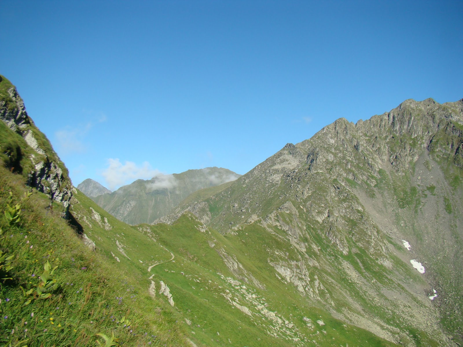
Fagaras Mountains are a mountain range which forms part of the Southern Carpathians, and is the highest mountain peak in Romania, Moldoveanu Peak 2544 meters. By Negoiu interwar period, with an altitude of 2536 meters, was considered the highest peak in the Carpathians, Tatras peaks exception.
Fagaras massif from east to west measured in a straight line, approximately 70 km from north to south and about 45 km. Fagaras mountains like a huge backbone oriented from east to west with ridges oriented north and south. Peaks in the north are much shorter and more abrupt than those of the south, which are long and smooth.
Fagaras Mountains are bounded on the west by the Olt Valley and east of the river Barsa Grosetului and Dambovita River. To the north are separated by a large tectonic steep, the Fagaras depression, also known as the Land of Olt. To the north, a distance of only 8-10 km, difference in reach over 2,000 meters. South, delimitation is much less pronounced, was made after long ridges 30-40 km (tiles, enslaved, Scarisoara, sand, ŽARNIĆ, etc..), The string depressions Campulung Bradetu, Arefu and Jiblea.
The total area covered by the Fagaras Mountains is more than 2,400 km ², being, for comparison, about 7.5 times the Bucegi Mountains. Throughout the extent of Fagaras there are eight peaks over 2,500 m: Moldoveanu 2,544 m, 2,535 m Negoiu with, Vistea Great 2527 m, 2522 m Caltun-Lespezi with, Hunt Buteanu to 2507 m, Cornu Caltun to 2510 m, Hartopu to 2506 m, 2501 m there with Dara also with 42 peaks over 2,400 m and more than 150 peaks over 2,300 m.
These peaks are separated by deep saddles, some down to below 2000 m (saddle ŽARNIĆ: 1932 m).
This density peaks, slopes, peaks and heights have attracted massive and called Transylvanian Alps, French scholar Emmanuel expression attributed to Martonne.
Detach from the ridge to the north and south, strong like stone buttresses, a large number of loins extend (up the mountain) located almost perpendicular to the ridge. They have different lengths and especially appearances as face north or south. Northern branches are mostly steep and rocky near the ridge, just below the mantle appease the coniferous forests that occur immediately falls below 1,700 m height Another feature of these branches is their appearance and sometimes very narrow edge serrated (eg edge Albota).
In striking contrast to the northern branches, which shall break the backs south ridge (Muntenia) are long and slow, partly covered by pastures.
Main ridge of Fagaras and northern branches subjected to the action of currents and disintegration caused by freezing and thawing stitching forming in some places very narrow, notched saddles such as: Port Arpasul the Dragon window, saddles of Serbota valleys (north), springs Scale and Negoiu (south).
Another feature of this is the numerous glacial mountains and alpine lakes located at high altitudes. Some of these lakes are fed by underground springs.
Lower valleys to the north (Transylvania), is mostly a direction nearly perpendicular to the ridge line, and their waters are forced - due to very inclined slope - to descend into jumps, forming numerous waterfalls. Among the most picturesque valleys are: valleys midwives, Serbota, Bale, Brezcioarei, Ucei Great and Ucisoara, Saturday.
Fagaras mountains are crisscrossed by the highest road in Romania, Transfagarasan.
Fagaras massif nature reserves are less than the wealth of endemic plants and beautiful landscape areas.
Baldea alpine and lake. With an area of ​​120.45 hectares, the reserve covers an area south of peaks guarded Buteanu Hunt (2508 m), Capra (2450 m) and Paltinu Mare (2480 m) on the western flank of Buteanu edge and on the eastern Balea edge. Reserve includes glacial Balea glacial lake of the same name, the largest glacial lake of Fagaras Mountains.
Reserve Arpasel. With an area of ​​736 ha reserve is located on the northern slope Arpasel the Fagaras Mountains, including alpine, subalpine and upper mountain from 2,500 m to 1,000 m altitude.
limestone from Turnu Red. Located near the village Turnu Red, comprises a strip of limestone superimposed on crystalline schists. Included in these limestones rich deposits of fossils, scientifically interesting.
Clothes Vegetable Fagaras Mountains is a very rich and varied. Compact forests cover the mountain slopes up to a height of about 1,700 m, and large meadows and glades - adorned with all kinds of flowers - span the banks of valleys, forest clearings or wavy lands under forest belt of the mountain.
Beyond the meadows begin beech forest region that covers much of the mountain foot. Beech grows here strong, tall and straight, forming forests really great. For the beauty of silver beech forests of the valley Bale as for other tourist values ​​that are over them (rocks, lakes and waterfalls), this valley was declared by the Commission for the protection of natural monuments nature reserve. In beech forest clearings and banks that water meets capreasca willow, birch, aspen, alder, raspberries, blackberries.
At the top of the forest, mixed with beech tree that is quite rare. Instead, his place is taken by spruce woodland occupying the entire region, from 1,100 to almost 1,700 m altitude.
Apart from these two representatives of conifers, in Fagaras still meet other resinous essences. Thus, larch and larch (Brezcioarei Valley) pin (Valley House, Mountain Slope), yew (in greater numbers Edge midwife) zambru rare specimens, and quite often juniper (Santa Edge). Of these, larch, yew and Zambra species are protected by law.
Above molidisului alpine start, often interrupted by numerous clusters of juniper trees, juniper, blueberry and cranberry. Is mainly alpine meadows covered (especially on the southern slope of the mountain) providing abundant food numerous flocks of sheep. Also in this area meet various species of flowers, some beautiful and interesting than others: smirdar, Campanu (bells dwarfs), gentiene, forget-me-not, panseaua mountain, Russian, Garofita mountain tribute. Of flowers protected by Law: Sunflower Queen, also known as "Edelweiss" brave blood, white ivy. In mid-June, up in the alpine mountain peony blossoms, which takes the form of a fragrant flowers, a bright red blanket enveloping the mountain as seen from a great distance, and when the wind blows feeling that burning mountain . Locals on the last Saturday in June used to climb, young and old, the peony festival.
Fagaras Mountains chain contains a rich fauna, both in subalpine areas, mostly covered by vast forests and alpine areas. Among mammals Carpathian bear (protected by law) is the most representative, maintaining shelters in many parts of the upper coniferous forests. In lower elevation forests, wild boars offers another precious game in both northern mountain lands and in the south. Marten and lynx are found less frequently. Instead, squirrel appears everywhere in the way of hiking in forest regions where the mainstay is the fox. Deer and deer forests give charm to the hem. Wolf is also present in these places.
Many birds beautifies forest life: meet scissors, finches, mountain cojoaice, woodpeckers, thrushes, wagtails berries, honey. Grouse and grouse are nestled in thickets. Of birds of prey living in heavily: eagles, hawks, eagles or griffins forest, wind, and rarely eagles rock. Many reptiles, some harmless as lizards mountain and batracienii gusterii such as salamanders, teeming with carpets of dead foliage. In some places, the slopes oriented towards the sun, inhabit and vipers. Many mountain streams and alpine lakes are now restocked with trout. Lives atop chamois, protected by law.
And with this we are finished for today! God bless you!